
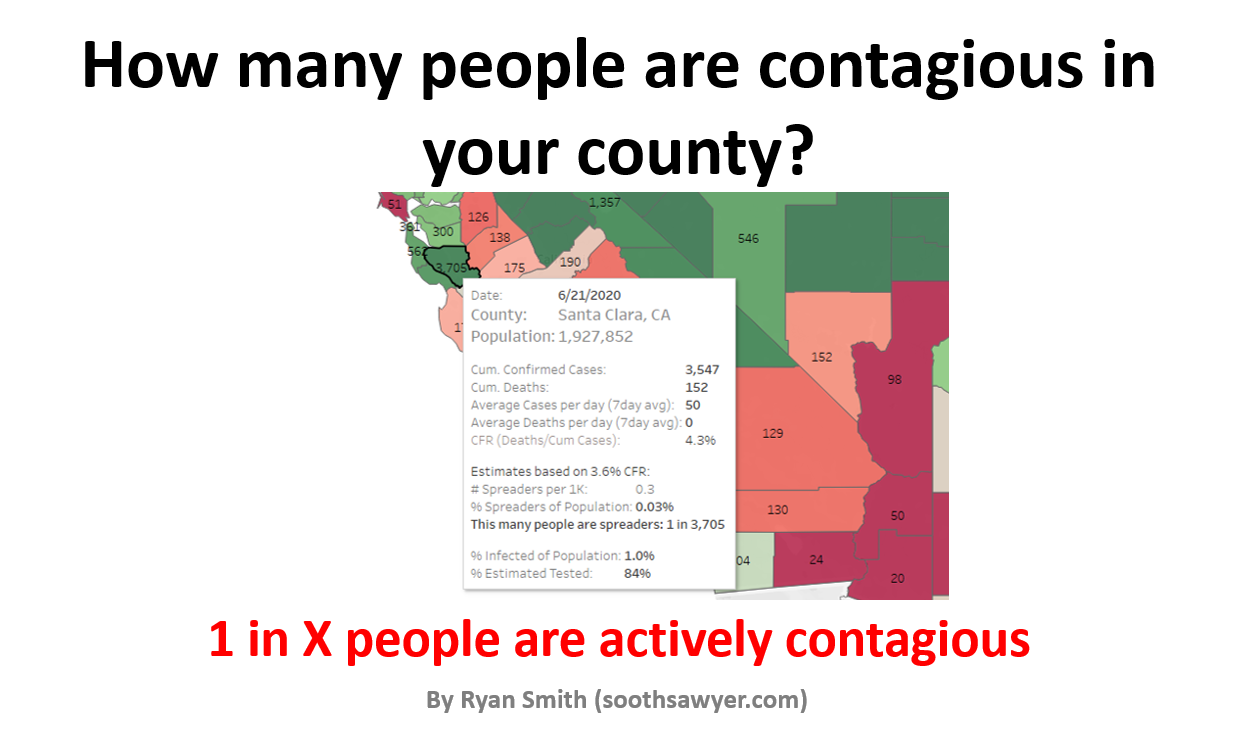
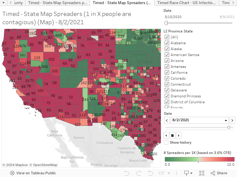
Have you wondered how to translate COVID-19 cases and stats into meaningful information like how many people around you are *actually* contagious? If so, you found the right place because this interactive map of the U.S. will show you how many people you have to be around to statistically bump into 1 person that is contagious with COVID-19.
I refer to these people as “spreaders” because they are pre-symptomatic, a pre-confirmed case, or asymptomatic carriers. Confirmed cases does not tell you this information. If you want to see how I calculate “Spreaders”, I wrote a post on this here.
View the above interactive map in full screen directly on Tableau by clicking here
Note: There is always a 7-day lag for calculating “Spreaders” because I must use future confirmed cases to determine who was spreading before they realized they had it. Also important is that the lower the number you see, the worse it is because you have to be exposed to less people before you bump into one person that has it.
Tip: Hold your mouse over any county to get more helpful information. Also use your mouse to drag the map to see other areas of the U.S.
Now you can understand your chances of being around someone with COVID-19 when you go on a hike, shop at the supermarket, or have a front yard gathering.
Nice little insight: The safest place to be in California (as of 6/29/2020) is in Santa Clara!
-Ryan

I have been around IT since I was in high school (running a customized BBS, and hacking) and am not the typical person that finds one area of interest at work; I have designed databases, automated IT processes, written code at the driver level and all the way up to the GUI level, ran an international software engineering team, started an e-commerce business that generated over $1M, ran a $5B product marketing team for one of the largest semiconductor players in the world, traveled as a sales engineer for the largest storage OEM in the world, researched and developed strategy for one of the top 5 enterprise storage providers, and traveled around the world helping various companies make investment decisions in startups. I also am extremely passionate about uncovering insights from any data set. I just like to have fun by making a notable difference, influencing others, and to work with smart people.